Science Involved
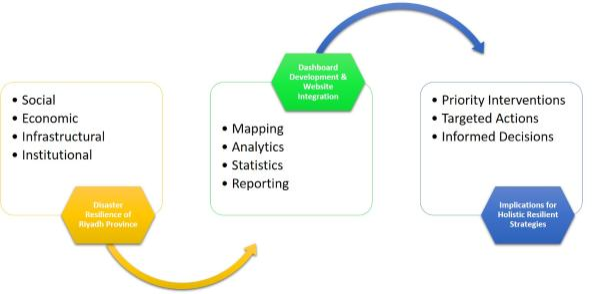
The concept of cities being resilient is undeniably linked to the resilience of individual urban neighborhoods, making it imperative to plan and design neighborhoods purposefully. Hence, access to information about neighborhood-level resilience and its dynamics to decision-makers, urban planners, and government officials is a prerequisite to identifying spatial segregation, least resilient areas, and inequitable gaps to develop effective solutions. Assessing disaster resilience involves systematic approach. To begin with, understanding the resilience concept and defining its sub-components (i.e., the sub-systems of cities/communities that drive overall resilience) is an integral step. From resilience assessment to informed planning The overall workflow can be segmented into two major modules. The first module deals with the collection of relevant data and computation of resilience indices in a spatial environment. The second module consists of leveraging ArcGIS Online solutions to develop resilience dashboards and integrate them into a centralized website for collective and comprehensive resilience communication. Based on these modules and their outcomes, key insights and potential implications are provided to support targeted actions and priority intervention areas.
From resilience assessment to informed planning