At KAUST Urban Lab, we leverage cutting-edge integrated and monitoring systems to gather precise, real-time environmental and urban data. These systems enable multi-scale research in climate monitoring, air quality assessment, spatial mapping, and infrastructure performance. By combining aerial, mobile, and stationary sensing platforms, we empower our researchers to analyze complex urban dynamics with high spatial and temporal resolution. Below is an overview of our core monitoring technologies.
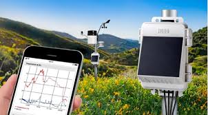
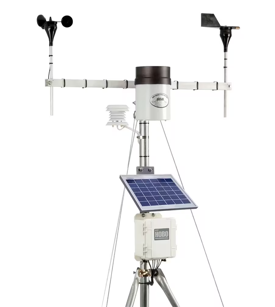
HOBO Integrated Weather Stations
- System: Onset HOBO Weather Stations
- Purpose: Climate Monitoring at Micro and Local Scales
The HOBO Integrated Weather Stations provide comprehensive environmental data through compact, versatile, and customizable sensor units. Equipped to monitor wind speed and direction, air temperature, relative humidity, solar radiation, barometric pressure, rainfall, and leaf wetness, these stations help track meteorological patterns critical to understanding urban climate and thermal comfort. Each of the 10 units is connected to a cloud-based data platform, allowing remote, real-time data logging and access. These systems are ideal for site-specific studies across urban, coastal, or arid environments and are widely used in our projects on walkability, thermal comfort, and urban heat island mitigation.
3D Scanning & Thermal Imaging: DJI Matrice 350 RTK
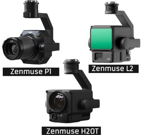
- System: DJI Matrice 350 RTK with Zenmuse L2, P1, and H2OT Payloads
- Purpose: Aerial Mapping, Infrastructure Inspection, and Environmental Modeling
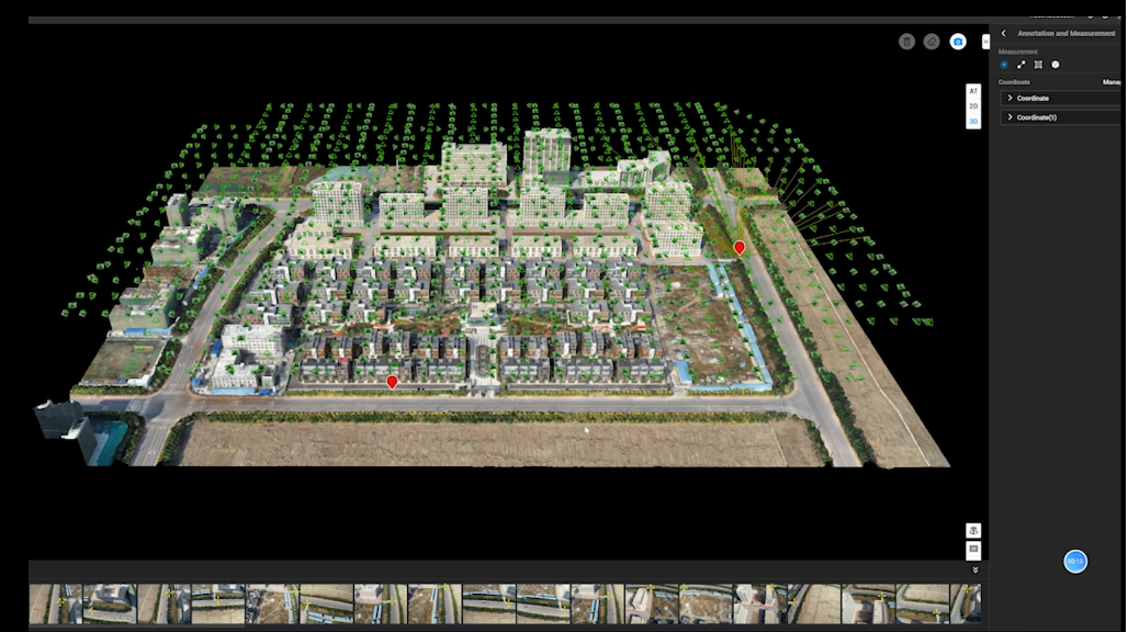
The DJI Matrice 350 RTK is a robust commercial drone platform optimized for high-accuracy 3D mapping and scanning. It supports multiple payloads, including:
- Zenmuse L2: A LiDAR + RGB camera capable of near real-time data capture, ideal for topographic mapping and modeling built structures with centimeter-level accuracy.
- Zenmuse P1: A high-resolution camera tailored for photogrammetry, allowing efficient and detailed visual data collection over large areas.
- Zenmuse H2OT: A hybrid sensor combining thermal imaging, zoom, and laser rangefinding, offering rapid multi-perspective data for infrastructure inspection and environmental monitoring.
Together, this payload suite enables efficient modeling of complex environments, structural analysis, and climate-related data collection, serving both research and outreach activities.
Air Quality Monitoring with DR2000 + Urban Scanner
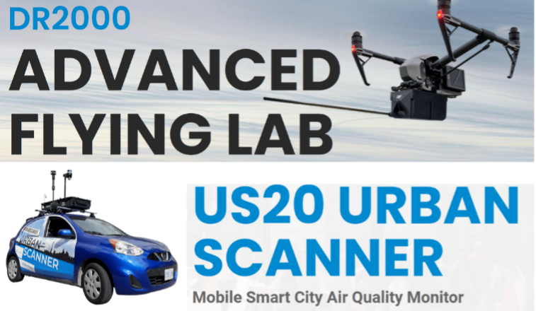
- System: Scentroid DR2000 Drone Air Quality Analyzer and US20 Urban Scanner
- Purpose: Vertical and Mobile Air Quality Mapping in Urban Environments
These systems allow high-resolution air quality assessments both from the air and ground.
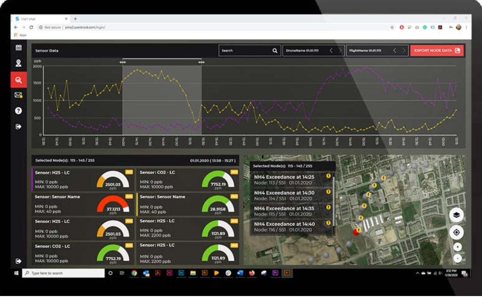
- The DR2000 drone can monitor atmospheric pollutants such as SO₂, VOCs, CH₄, and particulate matter (PM1, PM2.5, PM10) at altitudes up to 125 meters. It records GPS location, altitude, and meteorological data every 2 seconds, generating real-time maps of emission plumes and pollutant dispersion patterns.
- The US20 Urban Scanner is a mobile terrestrial platform capable of simultaneously recording air quality data, 3D urban geometry, traffic flow, and local weather conditions. It supports up to 15 integrated sensors and is ideal for urban corridor studies and public health research.
These tools support our efforts in climate adaptation, resilient design, and air pollution exposure studies across dense urban fabrics.
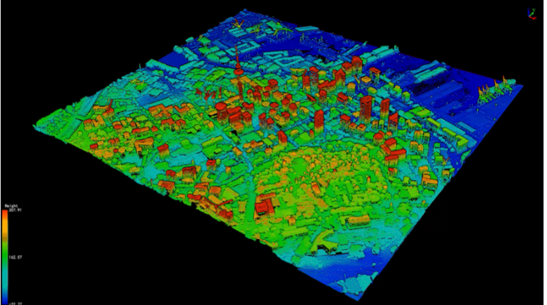
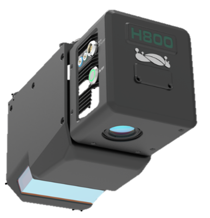
GreenValley International LiAir H800 UAV LiDAR System
- System: LiAir H800 with DJI Matrice Drone Integration
- Purpose: High-Resolution 3D LiDAR Mapping of Terrain, Infrastructure, and Vegetation
The LiAir H800 from GreenValley International is a next-generation UAV-mounted LiDAR system engineered for aerial spatial data acquisition. Designed specifically for integration with the DJI Matrice platform, it combines advanced laser scanning with GNSS and IMU systems for accurate 3D mapping in complex environments.
This system provides highly detailed models of topography, built structures, road networks, and vegetation. Its outputs are critical for analyzing urban form, drainage patterns, and infrastructure risks. Accompanied by robust software for data post-processing, the H800 supports applications in environmental planning, infrastructure monitoring, disaster risk analysis, and ecosystem assessment.